The South Wales Caving Club Expedition
To
The Ardeche
31st July - 14th August 2021
Lead contact: Chloe Francis
Phone: E-Mail: ardeche2021@swcc.org.uk
INFO
![]()
![]()
![]()
![]()
![]()
![]()
Links
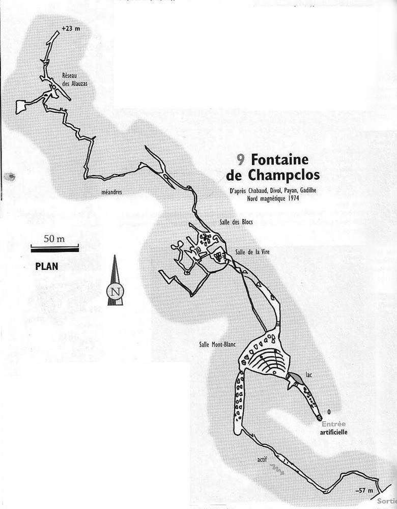
Grotte Nouvelle de Vallon Description
Caving in the Ardèche
This cave is among the "classics" of the region. It is renowned for the awesome abseil entrance (a wall is lost at each rebelay), its sizable galleries, chambers and its varied formations (stals, gypsum flowers, helictites etc...), which are still in excellent condition thanks to a booking system.
Coordinates:- 31T 622926 4909347 88
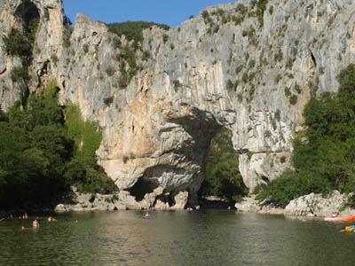
Part of this cave is a show cave; this itself is worthwhile - especially the sound and light show on the famous gour pools. This extensive system has close to 50km of surveyed passage, and offers a number of extensive trips, including the classic through trip from the Aven Despeysse
Aven Despeysse
Coordinates:- 31T 624414 4911277 212

Coordinates:- 31T 594341 4908306 205
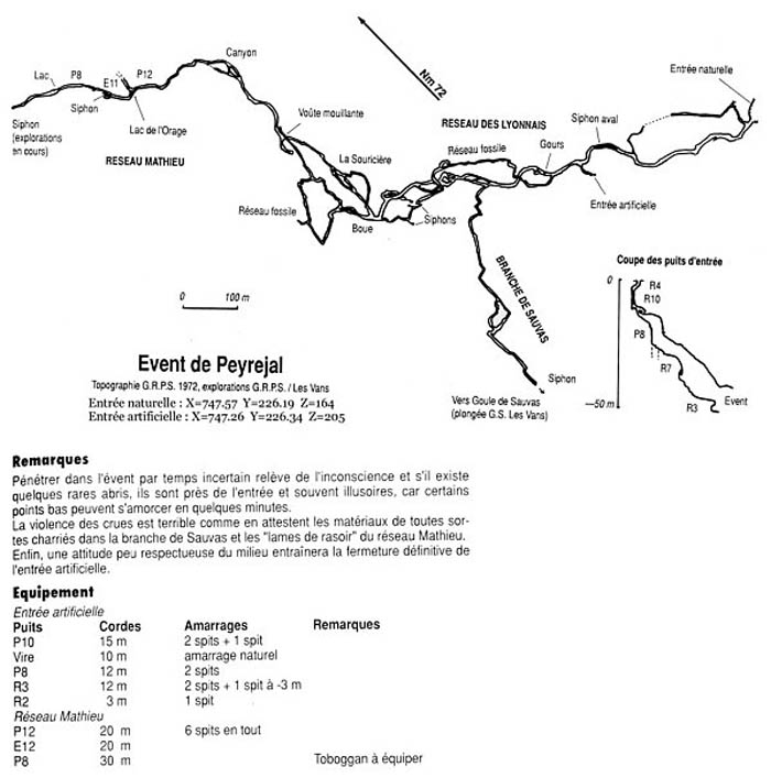
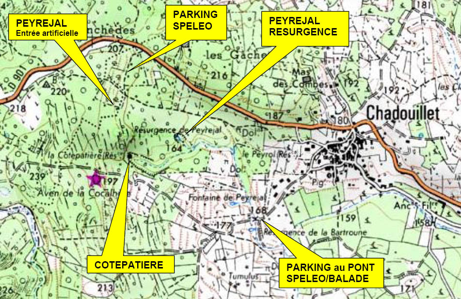
The Event de Peyrejal is part of an extensive system linked via long sections of submerged cave. Trips can be made into this middle part of the system via a blasted entrance. From the base of a series of pitches you can explore a fine series of phreatic passages, some not unlike DYO’s Bakerloo Straight.
Aven des Pebres
Coordinates:- 31T 605420 4898570 275
A fine caving excursion with walk to the entrance of 10 minutes. A translated description of the cave reads:
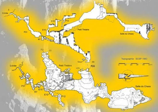
The entrance is at the foot of a small cliff by a well-threaded low corridor leading to the top of a 31-meter well. This well is in fact a succession of small inclined notches. At the bottom of it, go up a flow and cross a low passage then a jump of 7 meters. A few more low passages and then we enter the great room. This room is only a vast corridor plunging from -55 to -88 m. This room is remarkable for its volume, the presence of large stalagmigtic pillars and the powerful flows. Starting from the large hall, a 12-meter climb leads to a balcony overlooking it. From this point, two possibilities: either continue to climb the ascending step (E15 + E10) passing through a succession of small concrete rooms which bring us back to the zero point, or go down a small notch then go up and cross a ledge overlooking the large one. room. We are then at the beginning of a large upper network which begins with a scree. After climbing 6 meters, the network becomes chaotic. It ends with a last room where there is a strong concretion in part N. On the way back, the turn can be avoided by placing an abseil for a direct descent into the room.
Coordinates:- 31T 612800 4916709 230
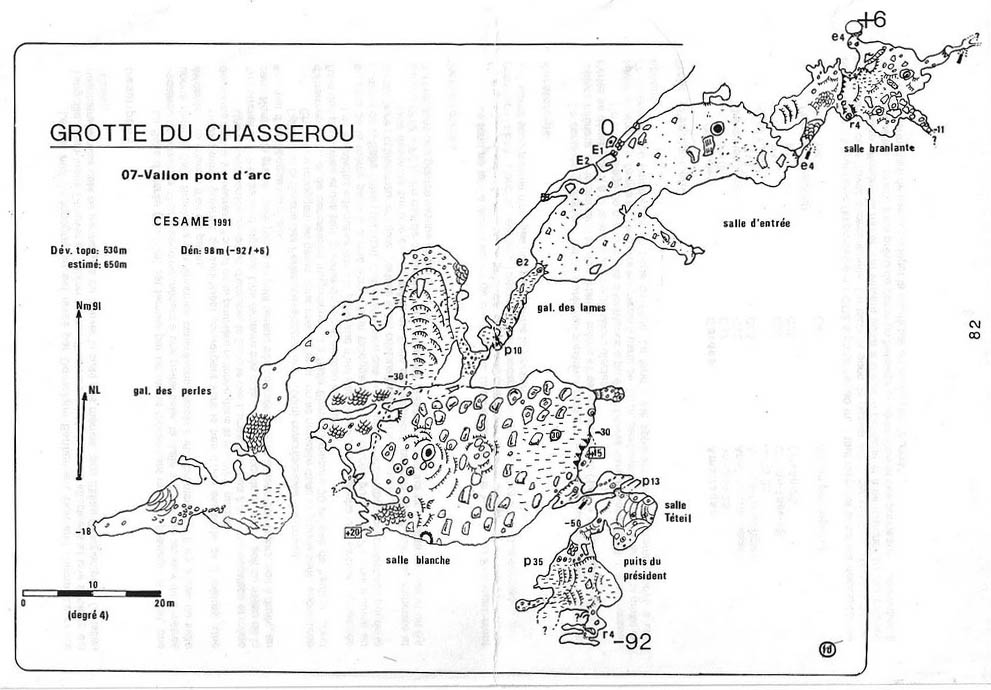
The Chasserou cave is located on the hill that bears its name (also called "Colline d'Arduc”).
The entrance has revealed traces of human occupation
dating back to prehistoric times, and well-decorated chambers were found
beyond this in 1988. Later, during new explorations, other parts, including
the `White Room’ have been revealed. Due to its
remarkable state of conservation, a visit to the cave requires care.
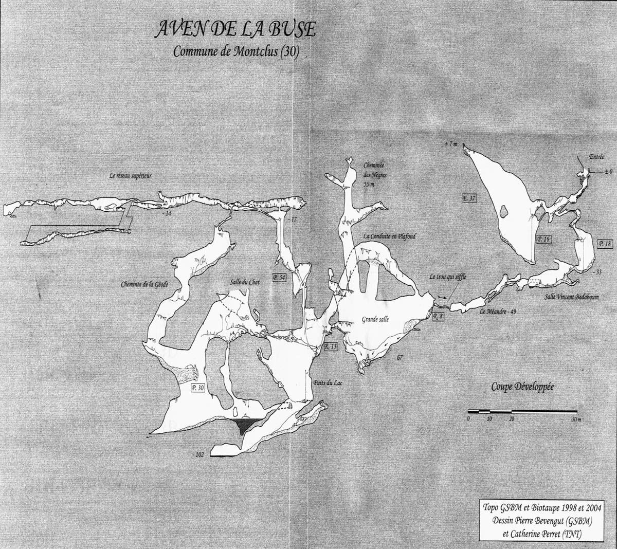
Aven de la Buse
Coordinates:- 31T 611531 4903993 195
Aven de la Buse The entrance is in a drain next to a road, having been discovered during recent road-widening! After a challenging entrance, the cave is extremely well decorated with helictites up to 50 cm long, a forest of straws, and crystals growing out of the wall everywhere! Aven de la Buse The entrance is in a drain next to a road, having been discovered during recent road-widening! After a challenging entrance, the cave is extremely well decorated with helictites up to 50 cm long, a forest of straws, and crystals growing out of the wall everywhere! The entrance is in a drain next to a road, having been discovered during recent road-widening! After a challenging entrance, the cave is extremely well decorated with helictites up to 50 cm long, a forest of straws, and crystals growing out of the wall everywhere!
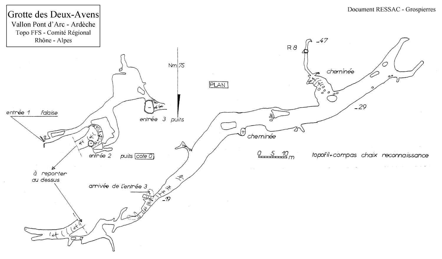
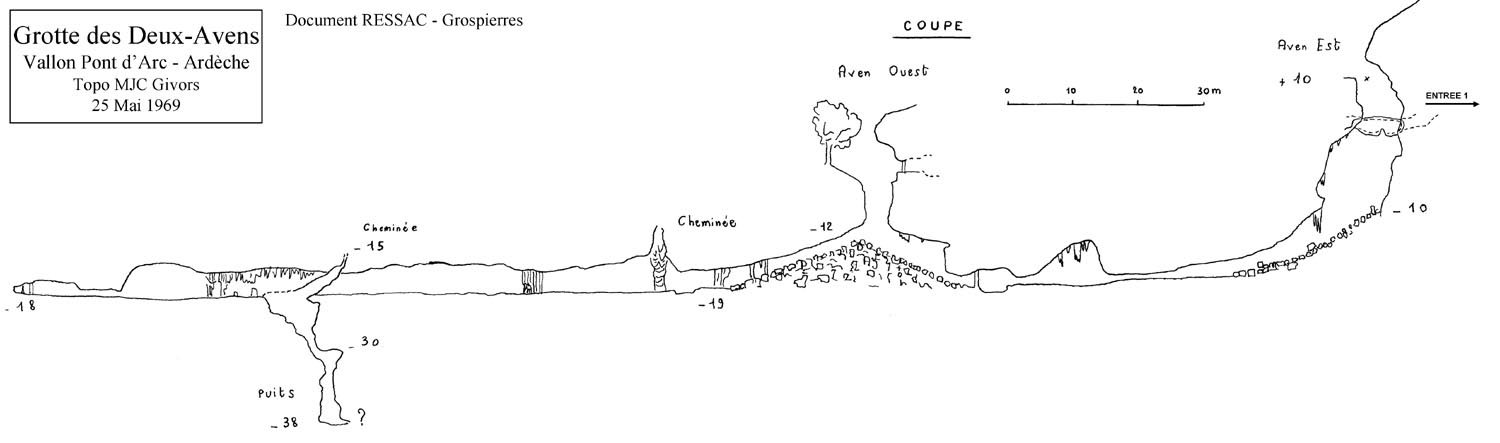
Deux - Avens
Coordinates:- 31T 612564 4916637 180
By this path, we therefore arrive at entrance n ° 3, the most westerly, a large inclined plane descends to the edge of the well (a handrail is recommended with mooring on a tree or bolt on the left on the ground). We can go to the left of the well, there are 2 good bolts for a full throttle descent. The well is about 10 m at this point.
You can also go to the right where there are also bolts
(Warning: risk of friction). A ledge with tree trunks also gives access
on the right to a spacious gallery where prehistoric excavations took
place.
If you continue on the trail, you will pass next to the central entrance
No. 2, which consists of a well of about twenty meters equipped with bolts.
Continuing on the path, you arrive at the most easterly entrance 1, which
opens up in the form of a cave at the foot of the cliff. Through this
entrance, you enter a gallery formerly closed by a door, which opens at
the end of about twenty meters of gallery slightly descending into the
20 m shaft (entrance n ° 2). The well is on the right, it can be lowered
quite easily by a ledge that goes around it to the left (Handrail 50 m
recommended.)
Straight on, the cavity continues and joins entrance 3, after taking a slightly ascending gallery and crossing a fairly large room from which several small diverticula leave.
From the bottom of the shaft at entrance 2, you descend the scree cone. On the left, a cat flap leads to a gallery which allows you to find the scree cone of entrance no.3 after about 40 meters, and we find ourselves at the bottom of this well. Opposite, we descend this scree and the gallery continues with good dimensions.
At the bottom, two small obstructed galleries and on the left, a step descends in climbing; at the bottom of this step, 2 chimneys and a short narrow and sloping gallery interspersed with a step of 8 m (climbing) which leads to the lowest point of the cave at - 47 m. (Google Translated).
Coordinates:- 31T 620294 4912185 306
From Aven de la Vigne Close description at point marked (*), continue along main track. Take the left at the next fork (easy to miss on the return). After about 100m there is a small path on the right marked with a red spot. Follow the path, which is marked with cairns and red spots, to eventually lead to the cave, a fairly large hole with impressive rattle concealed in the trees.
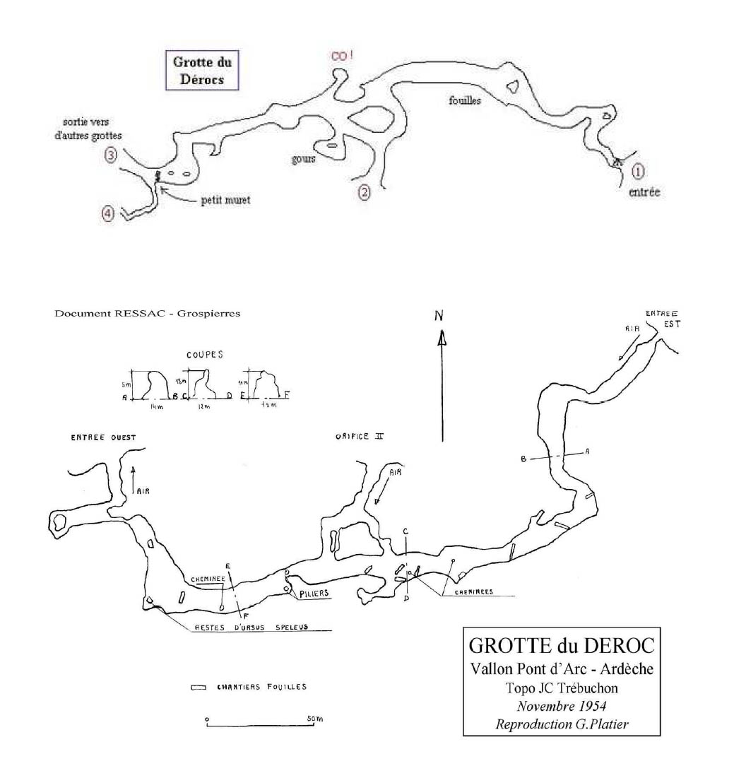
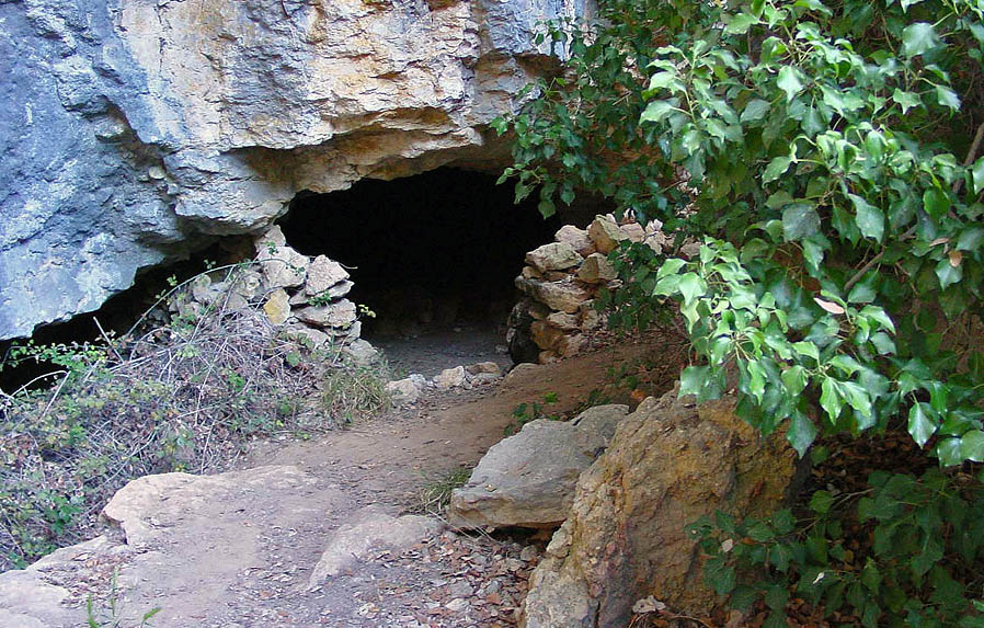
Grotte du Déroc
Coordinates:- 31T
612856 4916834 170
An easy cave with a few entrances, a walk through cave on one level.
This cave is located in the Ibie valley
between the Razal and D.290 bridges, near Vallon Pont d\u0027Arc.
From Vallon, take the D.290 road which leads to the Pont d’Arc,
take the first path on the left after crossing the Ibie river (around
1 km after Vallon in a sharp bend to the right). Follow this path for
about 400 meters, leaving a clearing on the left and Arduc hill on the
right. You then cross the GR4 perpendicularly, continue straight on leaving
a large wastewater treatment plant on the right. 200 meters further, as
the field ends on the left, a narrow path begins on the other side of
the path towards the hill. There are two possibilities then. The first
is to take this path which, after 600 meters of uneven route, joins the
western entrance to the cave. But it is not the easiest access. You can
indeed continue straight, the path is then no longer suitable for vehicles
and continues to skirt the Ibie before going to the right for an ascent
of several hundred meters on the hillside to the entrance of the Grotto.
de Louoi at the remarkable entrance porch. You must then go to the right
to take a low passage under a rocky outcrop and follow the base of the
cliff for about 50 meters to finally reach the eastern entrance to the
Déroc Cave.
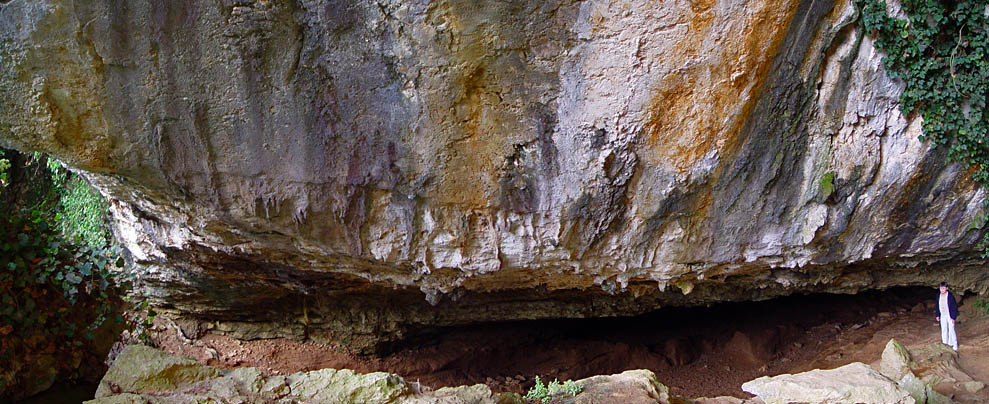
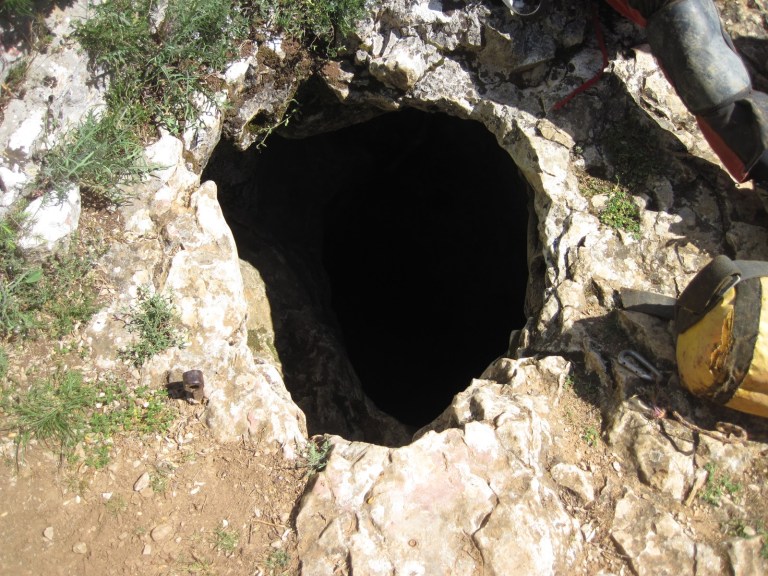
Grotte de Louoï
Coordinates:- 31T 612990 4916918 200
We have very little information about this cavity. It should be noted that it remains amazing in many ways. Indeed, this cavity is developing perpendicular to the axis of the cliff, but above all perpendicular to the neighboring cavities of Déroc and Deux-Avens which were said to be probably the same and very old water network of the Ibie river. before the latter sinks deeper into the valley. This anachronism of the position of the Louoi cave in relation to its neighbors therefore partially calls this theory into question. Moreover, unlike the Déroc, the Louoï cave experiences a sloping development, admittedly slight but continuous. Did this gallery give access to a network deeper in the hill? There is no evidence today to say so. Finally, if this cavity extends over 320 m, it does not require any special equipment and lends itself particularly well, like the neighboring Déroc, to initiation into caving. As for the entrance porch, it is remarkable and particularly marked.
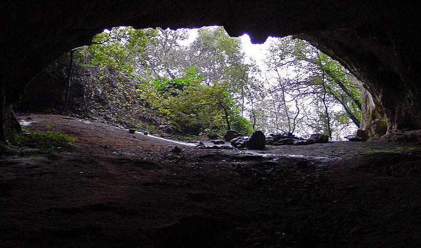
Grotte de Louoï entrance
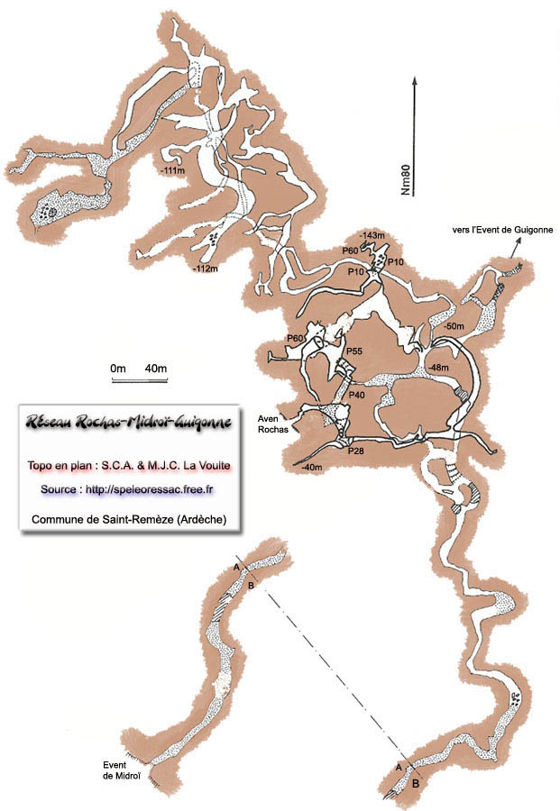
Traversée Rochas - Midroï
Coordinates:- 31T 617680 4910914 160
Superb through trip or as in and return trips at each end.
Évent de Foussoubie
Coordinates:- 31T 612113 4915191 162
From the submersible concrete bridge crossing
the Rieussec, continue for about 200 m along the right bank of the Ardèche.
To preserve the peace of the campers and according to the level of the
Ardèche, preferably follow the beach until completely beyond the
tennis courts. At the end of the beach, join the motorable path to the
campsite.
You quickly arrive at the end of this path. Go up the steep slope to the
right with a few steps and continue this path which leads directly to
the large vent of the Vent passing in front of the cave-sheepfold of the
Foussoubie vent.
Grotte-bergerie de l'évent de Foussoubie
Just before the large mouth of the vent, this shelter was built by the shepherds. Objects from the Late Bronze Age (Dr Fatou Collection) were found at the Foussoubie vent. Depending on their state of conservation a priori outside the flood zone, it is likely that they were discovered at the bottom of this small cavity of about ten meters.
Aven Cordier
Coordinates:- 31T 611976 4915297 195
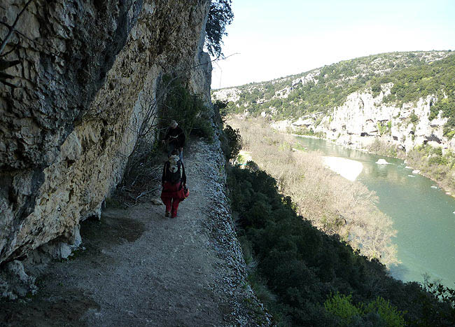
In the narrow path between the steps and the mouth of the vent, appreciably in the highest part, turn right in the buttress of the cliff and go straight up a well marked path. We arrive at a small escarpment that must be climbed to reach a ledge at the foot of the large vertical cliff. Follow this ledge to the right, upstream of the Ardèche. Almost at its end, Aven Cordier opens with a small opening at the foot of the cliff near a small shrub. Beautiful view of the Ardèche. Ventilated entrance.
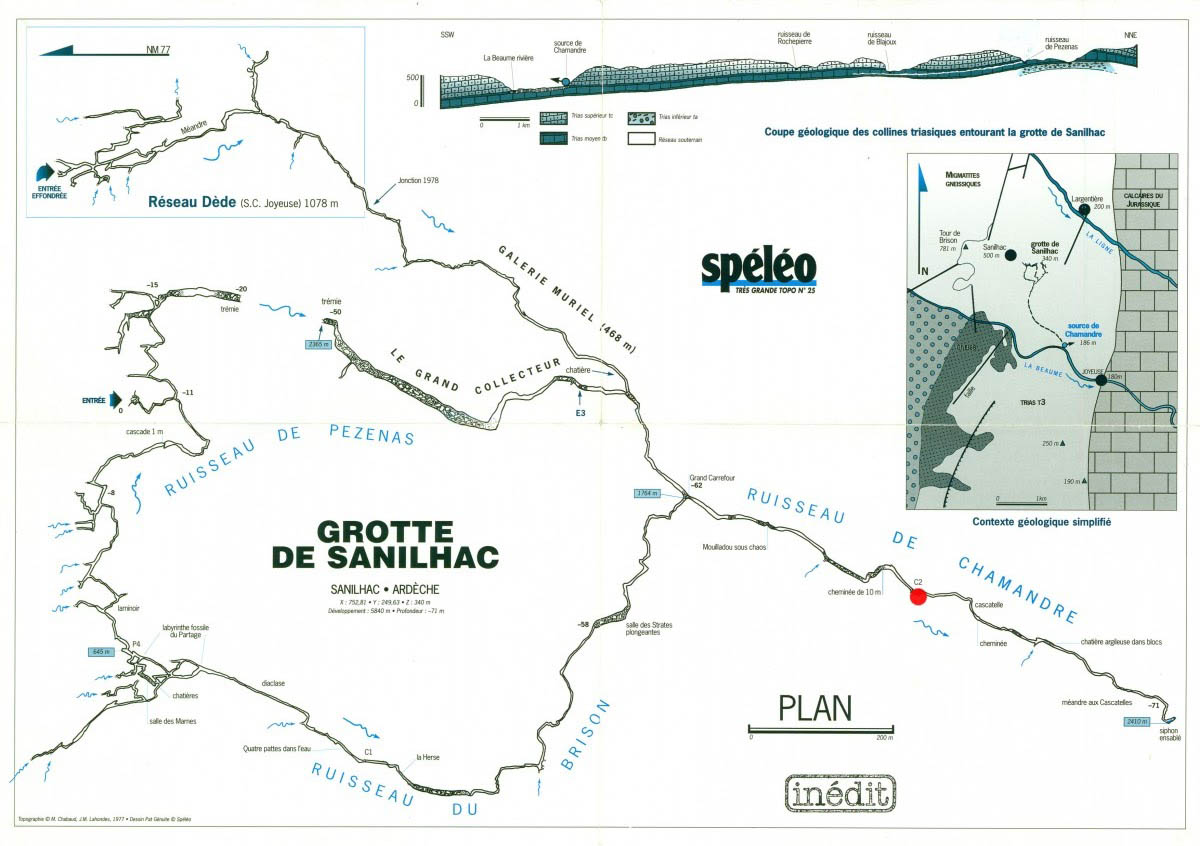
Grotte de Pezenas (Sanilhac)
Coordinates:- 31T 600072 4931582 340
The Pezenas cave (Sanilhac) is an important speleological network consisting of 15 km of galleries under the cover of Upper Triassic sandstone between the rivers La Ligne and La Beaume.
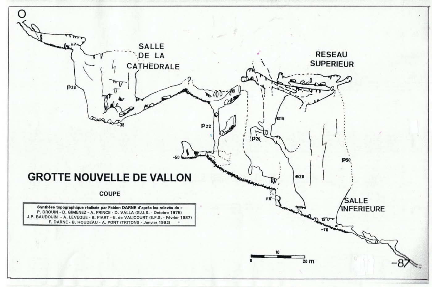
Grotte Nouvelle de Vallon
Coordinates:- 31T 612328 4916463 170
La Grotte Nouvelle is part of the Arduc hill and is therefore close to several other cavities such as Deux-Avens or Déroc. To get there, we will mostly take the same access path as to get to Deux-Avens: From Vallon Pont d'Arc, take the road to the Gorges de l'Ardèche in the direction of Pont d'Arc . As soon as you cross the Pont de l'Ibie, about 1 km after leaving Vallon Pont d'Arc, park in the first bend to the right (possibility of parking on the left). A motorable path then goes north. Follow this path for about 400 meters leaving a clearing on the left and Arduc hill on the right. We then cross the GR4 perpendicularly. Take it to the right (small stone stairs and ascending path with ruin at 50 m). Follow this winding GR for about 900 meters. After an S-bend, a marked path starts off to the left, take it for several hundred meters on the hillsides and cross a small valley. On the way up, instead of taking the Deux Avens trail, on the left, continue straight ahead for about 150 m uphill. We then arrive at the start of a small path on the right, the cave is there about twenty meters.
Entrance
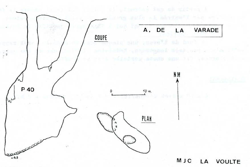
Aven du Varade
Coordinates:- 31T 621057 4913756 346
One first comes across a hole about 2m round which looks to be a 40m pitch to the bottom of the cave. Further across the limestone outcrop, there is a drop providing a view onto an earthen slope below. Traversing around through the trees along the right-hand side of the hole gains a stance where one can climb down into a crack to arrive at the top of the earth and moss slope. Except in the driest of conditions---and even possibly then---a rope is advisable, as although the climb poses no serious difficulties, a slip would have serious consequences as the slope below plunges directly into the shaft beneath. From the bottom of the climb, traversing carefully around to the right leads to a ledge which can also be accessed (arguably more safely!) by a pitch of about 10m from a small window to the left up on the outcrop (2 slings, 2 krabs, 2 hangers and maillons: backup to thread well back and then small thread above window, followed by Y-hang from bolts). The ledge commands a fine view up to daylight (vaguely reminiscent of Aven des Neuf Gorges) and down to the bottom of the shaft; the first surface hole enters on the far side of the shaft as one looks across. From the top of the climb one has a fine view of the hole and any cavers ascending this pitch. From the ledge it looks about 30m to the bottom of the hole; the aforementioned 40m pitch joins the shaft on the opposite side from the ledge.
Coordinates:- 31T 588335 4916548 240
Coordinates:- 31T 612864 4915662 100
Grotte de la Cotepatiere &
Coordinates:- 31T 594409 4908093 189
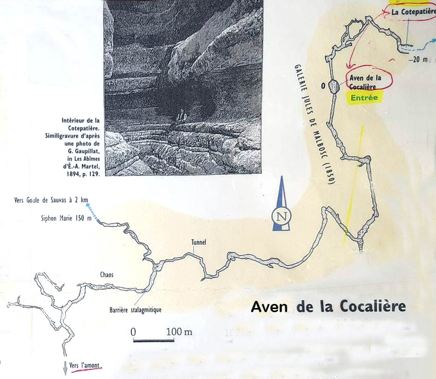
Aven de la Cocaliere
Coordinates:- 31T 594246 4907990 197
Updated 15.02.21